The possibilities of indoor positioning are unlocked in Tampere
16.6.2017The utilisation of indoor positioning is one of the hallmarks of a smart city. An indoor positioning ecosystem is under construction in Tampere, Finland, and practical examples of applications are becoming increasingly available.
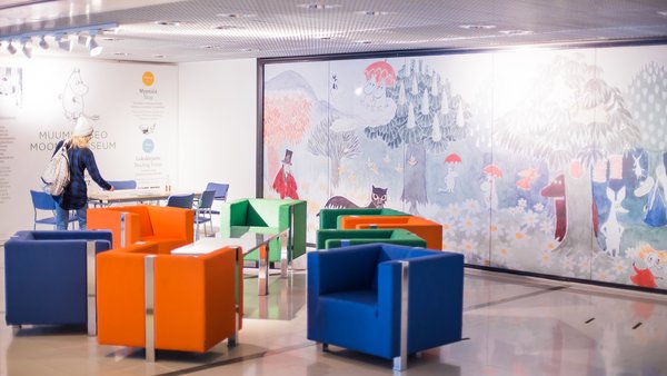
The new Moomin Museum in Tampere is a suitable destination for Moomin lovers – and anyone interested in the possibilities of indoor positioning. Museum visitors can use an application that enables them to picture their own progression in the museum, gain a wealth of additional facts about the exhibition in several different languages and information about the services available nearby. The content of the application is produced by the Moomin Museum, and Citynomadi from Tampere is responsible for the concept.
“For us, this is a dream project that is challenging in a good way. We were able to work on an application for an interesting attraction that will have a lot of visitors”, says Merja Taipaleenmäki, CEO of Citynomadi.
The Moomin Museum is a prime location for indoor positioning, and more are underway. The CityTrack project of the University of Tampere, for example, combines indoor and outdoor positioning in Tampere city centre and determines what kinds of services can and should be offered to people passing through the city centre.
“Take, for example, the Hämppi parking facility. Indoor positioning can be used, for example, to guide the people using the facility to park near the exit that is most convenient for them, and back to their own car upon their return”, says Jari Ikonen who is responsible for customer relationships at the Tampere Region Economic Development Agency Tredea.
An indoor positioning ecosystem is under construction in the city region: operators interested in the topic have been summoned to discuss the opportunities offered by this technology.
“An application for parallel funding is being compiled in June for this cause, and if someone wants to join in they can contact me”, Ikonen points out.
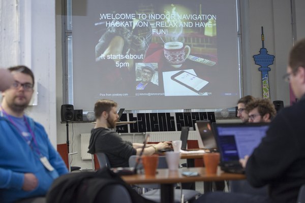
Cooperation was tried out in practice, for example, in the indoor positioning hackathon organised in the spring in which the participants brainstormed mobile guidance ideas for the Finlayson Art Area event. The event produced the desired result: that is, a concept for further development.
“Hackathons are one way to develop things in a new way; working together with a larger, more diverse team”, Ikonen says.
“For a small company, hackathons are a great place to show their skills. On the other hand, they also help you to figure out the direction in which you should take your own product development next – a company always has a lot of ideas, but it is not possible to invest resources in developing them all”, says Kalle Koljander from Citynomadi’s software team.
Citynomadi, which was established in 2009, visualises information and interactivity on a map in different ways. The company started with hour-long, story-based urban walks and next expanded its concept to suit an outdoor trail of 40 kilometres. There have been numerous applications since then, and the technology has matured.
“At first, people asked who even buys smartphones, or who can afford mobile data. Well, these things have since changed quickly”, says Sami Karhumäki from Citynomadi’s software team.
Citynomadi started with outdoor spaces but is now introducing indoor positioning to their system as well as a seamless combination of these. Different technologies are used in indoor and outdoor positioning, but end users should not be able to see the difference – for them, the information provided by the application is the most important.
Information also flows in the opposite direction. For example, when museum visitors use the museum’s indoor positioning application, the museum simultaneously receives large quantities of anonymous usage data.
“It can tell you how visitors have moved within the space at certain times, which items are particularly interesting, does something go unnoticed, could routes be improved... Or, for example, how much are the different language versions used”, Karhumäki says.
A combination of outdoor and indoor positioning has many potential uses: shopping centres, campus areas, hospitals, factory areas, airports and other transport hubs... The applications can be used to facilitate navigation, to attract people walking through to find local services and to locate moving objects, such as machinery or means of transport. There are almost too many opportunities.
“It is sometimes surprisingly difficult to tell customers everything that the application is and what it can do. The assumption is often that it is like a paper map in a digital format – but it can be much, much more”, Koljander says.
Article in Finnish: https://tampereenseudunvetovoima.fi/artikkelit/sisatilapaikannus-opastaa-houkuttaa-ja-tarjoaa-tietoa

